| |
|
|
|
|
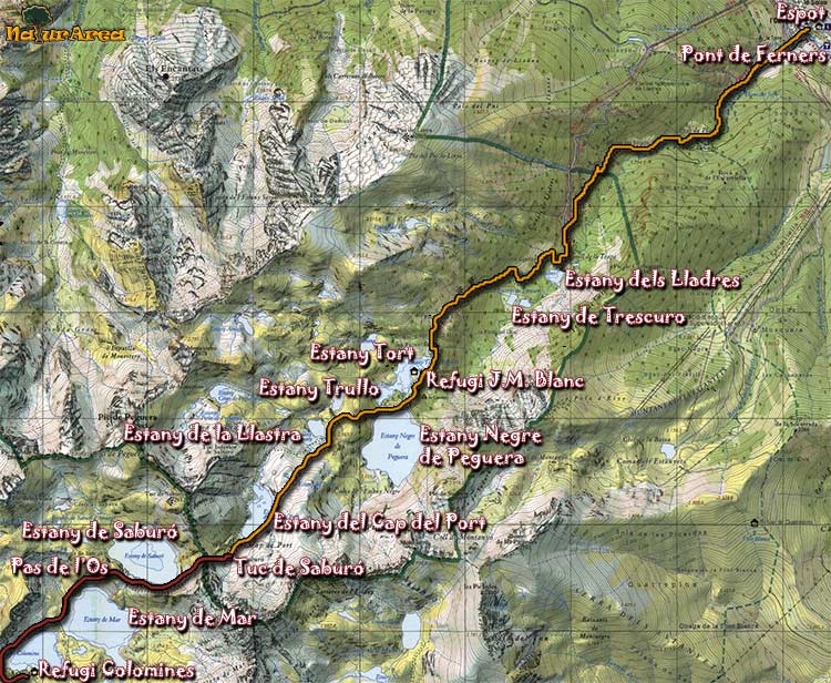
Location |
Peguera Valley. Pallars Sobirà. |
| Departure Point |
From Espot, deviation towards the station of local ski near the Bridge of Feners |
| Arrival Point |
Hill of Saburo |
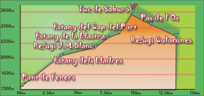
| Distance |
9Km (outward route). |
| Approximate time |
5h outward route- 4h inward route |
| Maximum height |
Hill of Saburó - 2912m |
Unevenness |
1558 |
| Difficulty |
Middle-Hight |
| Suitable time |
June - October |
| Notes of interest |
Part of the route is not signalled and it is outside of paths. The route can be extended until arriving to the Refuge of Colomines
|
| GPS |

|
|
|
1/4 |
 |
|