| |
|
|
|
|
Location |
National Park in Pallars Sobirà |
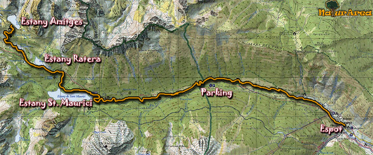
| Departure Point |
From Espot or from the parking at the entrance of the park (at 4km from Espot) |
| Arrival Point |
Refuge Amitges |
| Distance |
11Km (outward route) |
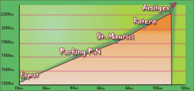
| Approximate time |
4h outward route- 2,5h inward route |
| Maximum height |
Refuge Amitges - 2380m |
Unevenness |
1063m |
| Difficulty |
Middle - Hight |
| Suitable time |
May - October |
| Notes of interest |
It is not allowed to go in car inside the park. It must be leave in established places. There is taxi-jeep service in the park |
| GPS |
>>Download Track<<
(Only to St. Maurici)
|
|
|
1/4 |
 |
|