| |
|
|
|
|
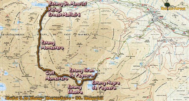
Location |
Refuge J.M. Blanc. Pallars Sobirà. |
| Departure Point |
Refuge J.M. Blanc |
| Arrival Point |
Lake of St. Mauricio |
| Distance |
11Km. (Outward route). |
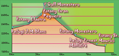
| Approximate time |
7h (outward) |
| Maximum height |
Mountain pas of Monestero - 2724 m. |
| Unevenness |
823 m. |
Accumulated ascent |
740 m. |
| Difficulty |
High |
| Suitable time |
From spring to autumn, if we want to do it without snow, then in August. |
| Notes of interest |
In time of snow we must be equipped with crampons, and it could be that the milestones and signposts were hidden under the snow.
Route that goes through different lakes and where you can admire magnificents views from the Mountain pass of Monestero at National Park.
|
| GPS |
>>Download Track<<
|
|
|