| |
|
|
|
|
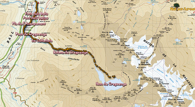
Location |
Plan de Bañs. Benasque. |
| Departure Point |
Plan de Bañs |
| Arrival Point |
Solana of Cregueña |
| Distance |
5Km. (Outward). |
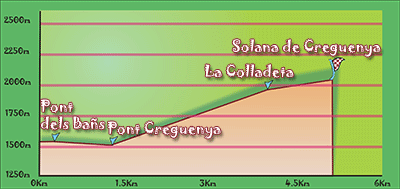
| Approximate time |
2h (Outward) |
| Maximum height |
Solana of Cregueña - 2050 m. |
| Unevenness |
525m. |
Accumulated ascent |
550m. |
| Difficulty |
Medium - High |
| Suitable time |
Spring - Summmer |
| Notes of interest |
Route of medium - high difficulty because of the strong gradient throughout its length. Not require any special technique but at some stage have to make small grimpe without difficulty for traversing a stretch of rocks.
|
| GPS |
>>Download Track<<
|
|
|