| |
|
|
|
|
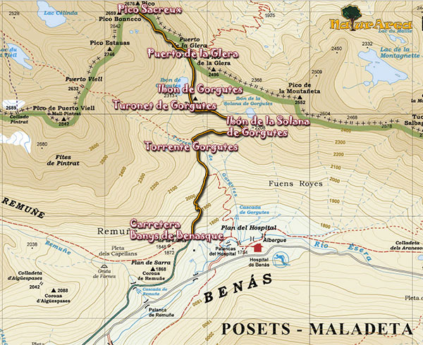
Location |
Benasque. |
| Departure Point |
Banys de Benasque road |
| Arrival Point |
Banys de Benasque road |
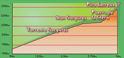
| Distance |
Km. 9 (Roundtrip). |
| Approximate time |
5.5h (Roundtrip) |
| Maximum height |
Peak Sacreux - 2676m. |
| Unevenness |
876m. |
Accumulated ascent |
877m. |
| Difficulty |
Low |
| Suitable time |
Spring - Summer |
| Notes of interest |
Route of low difficulty to reach the lake Gorgutes, the last part, up to Peak Sacreux, is of medium difficulty because we have to grimp for a considerable stretch and is not suitable for people who suffer from vertigo, but if we we decided to go we could see a breathtaking view of the French Pyrenees.
It is marked by stone marks and milestones throughout the journey, depending on the season we made it, it will be hidden under the snow.
|
| GPS |
>>Download Track<<
|
|
|