| |
|
|
|
|
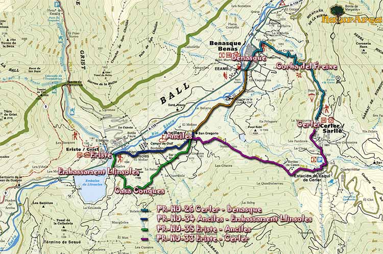
Location |
Cerler. |
| Departure Point |
Cerler |
| Arrival Point |
Cerler |
| Distance |
Cerler 17Km. (Roundtrip). |
| Approximate time |
6h (Roundtrip) |
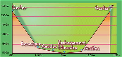
| Maximum height |
Cerler - 1550 m. |
| Unevenness |
450m. |
Accumulated ascent |
639m. |
| Difficulty |
Low |
| Suitable time |
All year |
| Notes of interest |
Although it is a route that can be done year round, be careful with the snow that may be in the winter time. We must also note that even a fairly level route is long and you must go prepared to walk.
If you like to see old houses and different escutcheon, the villages of Benaque, as well as Cerler and Anciles are ideal, simply stroll through the streets to see wonders.
|
| GPS |
>>Download Track<<
|
|
|