| |
Home >
Garrotxa N.P. >
Saint Iscle and Vallac valleys
|
|
Índice de Rutas
|
|
| |
|
|
| |
|
| |
|
|
|
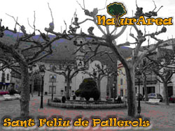
This route begins and ends up in Sant Feliu de Pallerols, municipality to the south of Garrotxa on Hostoles Valley.
It is a roundtrip route of little less than 17 Km and very complete where the river Bruent, flowing of Ter divides the term
and create more than 50 sources of water like the Fountain Teula, Mosquer and Fontana.
To the north we have forests of evergreen oaks and oaks,
and to the south, being part of the Natural Space of Collsacabra, Central European and Atlantic forests formed by oaks, beech groves and evergreen oaks...
In our route we will also see different churches like Santa Cecilia or Sant Miquel de Pineda, castles like Colltort or Salvador de Puig Alder,
and even volcanos like Traiter or Can Tià.
We will begin the route from the old area of Sant Feliu de Pallerols, where the church highlights. That church was built
in the XVI-XVII centuries, it has a single
|
nave with embedded chapels.
We will also be able to see the medieval bridge of Sant Sebastià, the remains of the Castle of Hóstoles of the XI century as well as the chapel of Nostra Senyora del Roser of the XVI century.
The route that we will make follows the old line way of the train of Olot. This road has been in disuse and now it is used as rail bike that joins
Gerona and Olot.
There are many routes that begin in this place, our number is 19, and is correctly marked in all the way through indicative posts.
Once we have left the town, to the right of the rail bike we will find the Office of Tourist Information, where we will be able to obtain information and maps
of the journey.
We will continue on the way and we will enjoy the numerous fountains, as Fountain Teula at only 50m of the exit of the town, we will enjoy the fields of corn,
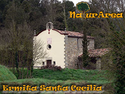
or the forest as well as the farmhouses and the hermitages that we will be on the road like Santa Cecilia.
|
A little later we will find the Romanesque church of s. XI named Sant Miquel de Pinena it is no more than 200m away from the rail bike.
This church has a single ship, with a steeple and an elevated apse, later on were added the chapels.
It was reconstructed partially after the earthquakes of 1427 that
destroyed it.
If we continue our way along the path we must cross the road C-63 taking care of the cars.
Once we crossed we continue straight along the road that rises to the mountain and we won't leave it until almost reaching Volcano Can Tia.
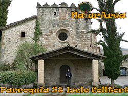
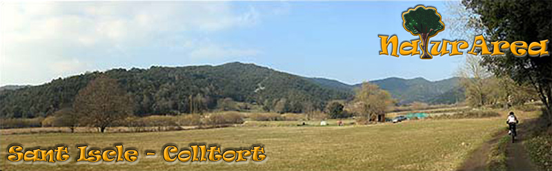
We can see fields and various farmhouses. If we continue along the road we will find the village of Saint Iscle de Colltort, it has also a parish of the same name.
The church of this parish is located at the base of the Castle of Colltort, and it was original of the XI century, although
|
|
|
|